


Randonnée pédestre
Tour of Vallon de Van
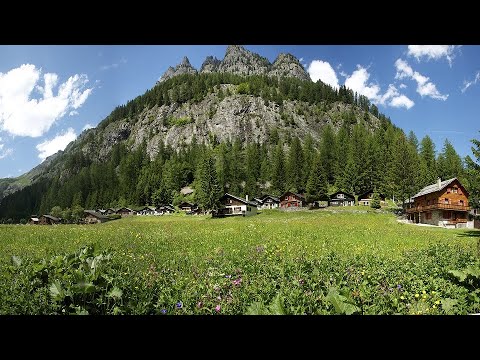
Salvan - Les Marécottes
Starting from the Auberge du Vallon de Van or from the campsite at Van d'en haut, take the path marked with a red arrow with the inscription "Tour du Vallon de Van".
The route allows you to make a 2-hour loop along the Salanfe river.
Technical information
-
Distance 6.76 km
-
Positive elevation 278 m
-
Negative elevation 278 m
-
Highest point 1'269 m
-
Duration 2h00min
Location / Access
GPS coordinates :
46.14030306267047, 7.015286954847398
Access :
Access :
By vehicle
In summer :
- Exit the A9 motorway at Martigny, follow signs for Salvan (20 minutes)
- From Salvan, follow the signs "Vallon de Van".
- From Les Granges, the road is narrow and does not allow you to cross at all times. You will cross two tunnels limited to vehicles over 2m wide and 2m high.
- Free parking on site
In winter:
- Access by road is not passable.
- However, the access road is groomed and can be used on foot or with snowshoes (about 30 minutes).
By public transport
- On the CFF line between Geneva and Brig, stop at Martigny then take the Mont-Blanc Express to Les Marécottes - timetable
- From the Marécottes train station, a bus takes you to the Vallon de Van during the summer - timetable
Contact

Vallée du Trient Tourisme
email info@valleedutrient.ch
link https://www.valleedutrient.ch/
location_on
Rue Marconi 1
1922 Salvan


