



Restaurant
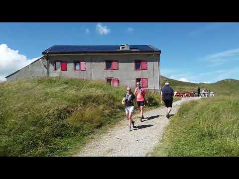
Refuge du col de Balme
Trient
Hikers from all walks of life are welcome, whether you are stopping off for a Sunday stroll or for a stage of the famous Tour du Mont-Blanc, the team looks forward to welcoming you in the summer months.
- Traditional soups
- Local dishes
- Home-made desserts
- Hot drinks
- Cold drinks
- Pancakes
Information
Services
- Terrace
- High-altitude restaurant
Bars and clubs
- Buvette
Payment methods
- Credit card
- Cash
- Debit card
Location / Access
GPS coordinates :
46.02672203160413, 6.970074176788331
Altitude :
2190 m
Environment :
Mountain
Access :
From Le Tour (France)
- About 1h40 on a good path through Charamillon
- About 10 minutes from the Col de Balme chairlift
Access from Trient (Switzerland)
- About 3h from Le Peuty
- Follow Col de Balme, Les Tseppes then by the Pas du mouton and follow the western slopes of the Pointe du Van and the Croix de Fer. After about 1 km, the path branches off to Col de Balme via Vallorcine or Arolette. Follow Arolette to reach the col de Balme, from Arolette there are two alternatives: either via L'Aiguillette or directly down to the col de Balme.
Contact

Henri Lapeyrere
phone +33 6 07 06 16 30
email henri.lapeyrere@gmail.com
link https://www.refugeducoldebalme.com/
location_on
Col de balme
1929 Col de Balme (Trient)
Social media
Related articles

